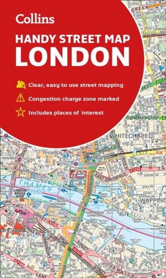
Collins London Handy Street Map
14
%
107 Kč 124 Kč
Odesíláme do 5 až 7 dní
Sleva až 70% u třetiny knih
Clear and easy-to-read map of central London and surrounding area. Contains detailed mapping, presented in a handy compact format. This attractive map, ideal for both tourists and residents, and fully updated, has an extensive area of coverage and displays a wealth of detail.
| Autor: | Collins Maps |
| Nakladatel: | HarperCollins Publishers |
| ISBN: | 9780008320584 |
| Rok vydání: | 2019 |
| Jazyk : | Angličtina |
| Vazba: | Sheet map, folded |
Mohlo by se vám také líbit..
-
Collins Student Atlas
Collins Maps
-

Collins Children's World Map
Collins Maps
-
Fife Pocket Map
Collins Maps
-
Short walks in the Peak District
Collins Maps
-

Children's Wall Map of the Unit...
Collins Maps
-

Collins Children's Picture Atlas
Collins Maps
-

The Complete History of Middle-Earth
Christopher Tolkien
-

Zero Negativity
Middleton, Ant
-

Nick and Charlie
Alice Oseman
-

The Little Teashop in Tokyo
Julie Caplinová
-

Bing: The Rainybow Song
-

The Final Twist
Jeffery Deaver
-

Animal Farm
George Orwell
-

Shadow Of The Fox
Julie Kagawa
-

Strangers
Taylor C. L.
-

Fat Chance
Lustig Robert


